


Satellite imaging is indispensable to humanity in today’s era. It tells a lot of things, and its most primary use is in the form of GPS and navigation. In real-time, you can get to know the traffic conditions, which is the faster route, if there’s some construction blockage on the road, etc.
But, do you know that this technology can be used to indicate how well a country is doing economically?
Satellite Images – Economic Status Indicator
A country releases its official data on the economy, but with small countries, there’s always a constraint of reliability. It is difficult to gather accurate data, and even if the govt somehow manages to do so, then they may not always reveal it correctly (true for non-democratic countries).
As space-tech is advancing, it is becoming cheaper to launch satellites orbiting the earth, and hence, there are more and more satellites that cover a large area. That means, it is possible to capture every country’s satellite images.
A team of researchers from Stanford University trained a computer to identify impoverished areas from satellite imaging in five African countries – Nigeria, Tanzania, Uganda, Rwanda, and Malawi.
The conventional method involves collecting data on foot by going house to house. Dr. Burke, Assistant Professor of Earth System Science at Stanford said
“We traditionally collect poverty data through household surveys… we send survey enumerators around to houses and we ask lots of questions about income, consumption – what they’ve bought in the last year – and we use that data to construct our poverty measures”
These surveys, however, require manpower, time, resources, high expenditure, and even then, the accuracy is not determined. In regions of armed conflict, collecting this data may be near to impossible.
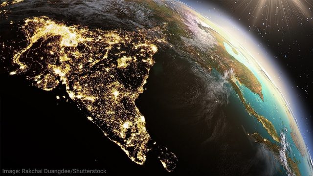
There’s an improved method to determine how well a region or a country is doing – using satellite images that capture night data. Daylight images capture infrastructure development – roads, pavements, houses, etc, that also help to determine the progress of a country economically.

There are several companies now that use this data to build software, know their market, understand the economic condition of a region, and a lot more.
The brightness of cities at night tells how they have progressed over time, and in comparison to other regions.
Read More: Rupee Becomes Asia’s Second Strongest Currency Through Stock Sales
Relevance To India
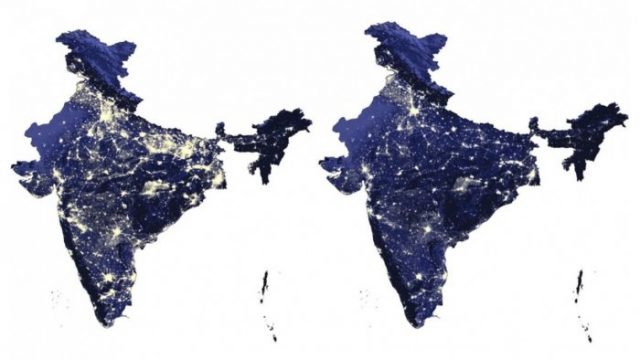
In the economic survey 2021-22, policymakers used space data to track longer-term socio-economic trends. They relied on various methods such as infrastructure development in cities and nighttime luminosity to come to their conclusion.
The images can tell the agriculture pattern. The policymakers can compare how the agriculture pattern has changed, i.e. what crop area has increased, what has decreased, how much agricultural land has been transformed to commercial land, etc.
Comparing the Kharif crop cycle in Moga District of Punjab during 2005 and 2021 shows that the crop cycle has shifted 2-3 weeks compared to previous levels, and now the timeline almost coincides with the Rabi crops.
Night-time images help understand which areas are most densely populated, i.e. the spread of urbanization. They help keep track of population density over time. The pictures sure look pretty.
However, this doesn’t mean that satellite imaging can be the sole source of this data. There are still so many things that it doesn’t tell. It cannot predict inflation, unemployment, consumer confidence, and other such economic indicators.
Nevertheless, this holds a massive potential to be used as a source of data in official govt policies. Indian companies can work towards making this technology more accessible and usable.
Disclaimer: This article is fact-checked
Sources: LiveMint, Deccan Herald, BBC +more
Image Sources: Google Images
Find The Blogger: @TinaGarg18
This post is tagged under: satellite images, economic indicator, economy, poverty, night time images, lighting, data, agriculture pattern, infrastructure development, scientists, space war, satellites, satellite imaging, researchers, artificial intelligence, policy making, mapping progress of a country
We do not hold any right/copyright over any of the images used. These have been taken from Google. In case of credits or removal, the owner may kindly mail us.
Feature Image designed by Saudamini Seth.
Other Recommendations:
Legalisation Of Gay Marriages Is Essential For The Indian Economy And Here’s Why


